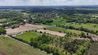
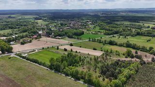
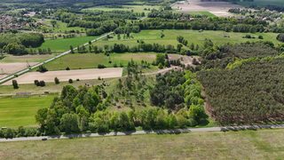
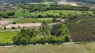
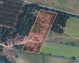
Agricultural plot next to a forest in Kuźniczysko, 14 km from Trzebnica Click a plot on the photo
1 / 23
Agricultural plot next to a forest in Kuźniczysko, 14 km from Trzebnica, photo 1Agricultural plot next to a forest in Kuźniczysko, 14 km from Trzebnica, photo 2Agricultural plot next to a forest in Kuźniczysko, 14 km from Trzebnica, photo 3Agricultural plot next to a forest in Kuźniczysko, 14 km from Trzebnica, photo 4Agricultural plot next to a forest in Kuźniczysko, 14 km from Trzebnica, photo 5Agricultural plot next to a forest in Kuźniczysko, 14 km from Trzebnica, photo 6Agricultural plot next to a forest in Kuźniczysko, 14 km from Trzebnica, photo 7Agricultural plot next to a forest in Kuźniczysko, 14 km from Trzebnica, photo 8Agricultural plot next to a forest in Kuźniczysko, 14 km from Trzebnica, photo 9Agricultural plot next to a forest in Kuźniczysko, 14 km from Trzebnica, photo 10Agricultural plot next to a forest in Kuźniczysko, 14 km from Trzebnica, photo 11Agricultural plot next to a forest in Kuźniczysko, 14 km from Trzebnica, photo 12Agricultural plot next to a forest in Kuźniczysko, 14 km from Trzebnica, photo 13Agricultural plot next to a forest in Kuźniczysko, 14 km from Trzebnica, photo 14Agricultural plot next to a forest in Kuźniczysko, 14 km from Trzebnica, photo 15Agricultural plot next to a forest in Kuźniczysko, 14 km from Trzebnica, photo 16Agricultural plot next to a forest in Kuźniczysko, 14 km from Trzebnica, photo 17Agricultural plot next to a forest in Kuźniczysko, 14 km from Trzebnica, photo 18Agricultural plot next to a forest in Kuźniczysko, 14 km from Trzebnica, photo 19Agricultural plot next to a forest in Kuźniczysko, 14 km from Trzebnica, photo 20Agricultural plot next to a forest in Kuźniczysko, 14 km from Trzebnica, photo 21Agricultural plot next to a forest in Kuźniczysko, 14 km from Trzebnica, photo 22Agricultural plot next to a forest in Kuźniczysko, 14 km from Trzebnica, photo 23

Description

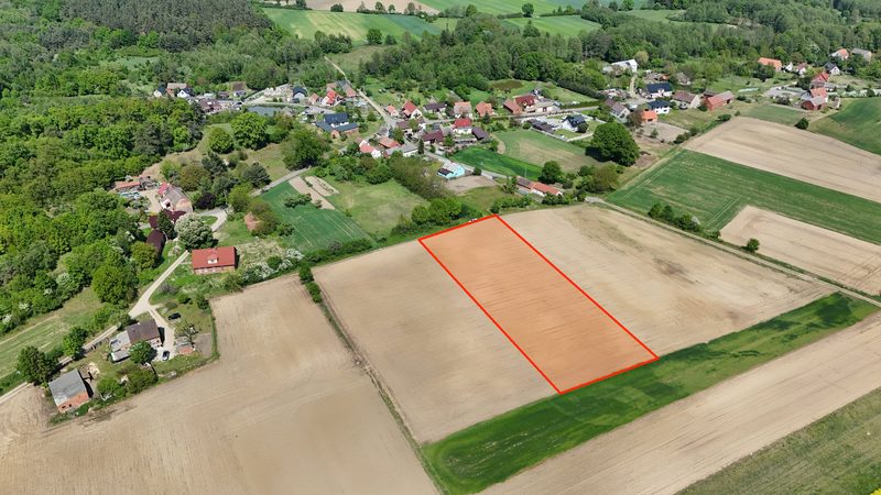
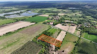
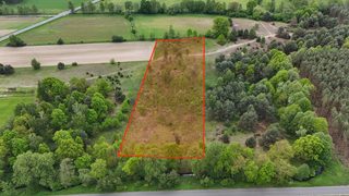
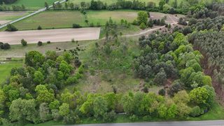
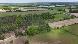
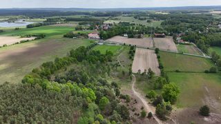
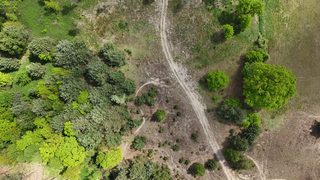
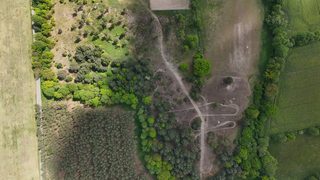
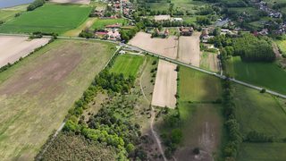
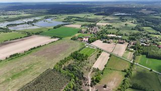
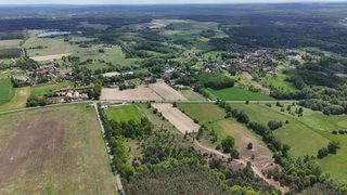
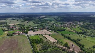
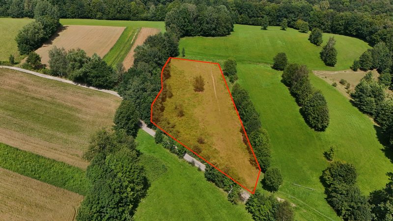
Agricultural plot for sale, 14 497 m² (nearly 1.5 ha) in one piece, in the village of Kuźniczysko, 14 km from Trzebnica, in gmina Trzebnica (municipality), powiat trzebnicki (Trzebnica county), Lower Silesian Voivodeship, south-western Poland. It is an elongated strip of land measuring approx. 75 × 213 m: to the west it adjoins the forest, to the east it is sheltered by a belt of trees. The terrain is flat, partly overgrown with young self-seeded birches and pines. A body of water lies approx. 500 m from the plot.
Location and access:

Kuźniczysko lies a dozen or so kilometres north-east of Trzebnica, where the Wzgórza Trzebnickie (Trzebnica Hills) meet the southern edge of the Kotlina Żmigrodzka (Żmigród Basin), among the forests of the former Skoroszów complex. Behind the belt of trees at the northern end of the plot runs the asphalt road through the village, a sandy unpaved road leads across the site itself, and the village buildings can be seen on the other side of the fields. From Trzebnica the S5 expressway (Trzebnica junction) leads in a dozen or so minutes to the boundaries of Wrocław; the whole route from the plot to the city is approx. 40 km.

Village and surroundings:

Kuźniczysko is a village of medieval origin with just under 400 inhabitants. It was founded as a forest colony where iron was smelted from local bog iron ore; from those earlier centuries there remain a historic water mill with the Izba Tradycji Młynarskich "W Starym Młynie" (Chamber of Milling Traditions) and a wooden former Protestant church from the 18th century. On site there is a primary school and a village community hall with a playground and an outdoor gym, and just behind the belt of trees by the plot lies the village football pitch. In the centre of the village, by the old mill, there is a group of ponds on the Sąsiecznica stream. Full facilities, including a hospital and a water park, can be found in Trzebnica, known for its basilica and the sanctuary of St Hedwig of Silesia.

Recreation:

The red Trzebnicka Pętla Rowerowa (Trzebnica Cycling Loop), a marked route of approx. 166 km around the municipality, runs through the village, and through neighbouring Koniowo and Koniówko passes the international EuroVelo R9 cycling route towards the Dolina Baryczy (Barycz Valley). The area is a mosaic of fields, meadows and forests: a natural population of brown trout has been recorded in the Sąsiecznica stream, by the village of Koniówko lie the Stawy Koniowskie ponds, a refuge for rare water birds, and by the forest settlement of Kuźniczysko there is an inland dune among the woods with sandy grasslands. To the south rise the Wzgórza Trzebnickie, known as the Kocie Góry (Cat Hills), with a network of municipal cycling routes.

Planning status:

No zoning decision (Polish 'warunki zabudowy', WZ) has been issued for the plot and no local zoning plan (MPZP) is in force here. This is agricultural land: it will work as a field, a meadow, an orchard or a recreational space by the forest. A zoning decision can be applied for independently at the municipality; the application may be submitted by anyone, not only by the owner of the land.

Utilities and access:

- access: a sandy unpaved road runs across the plot; the asphalt road through the village runs behind the belt of trees at the northern end of the plot - utilities: no information about connections, the village buildings are close by - a watercourse runs along one of the boundaries, under the line of trees

Distances:

- Trzebnica approx. 14 km - Prusice approx. 19 km - Milicz approx. 22 km - Oborniki Śląskie approx. 26 km - Twardogóra approx. 26 km - Wrocław approx. 40 km - Berlin: approx. 288 km in a straight line

Buying in interest-free installments without a bank:

- minimum down payment - 10% - after paying 10% you already become the owner - repayment in monthly or other installments - repayment period of up to 5 years (60 months) - no credit check - security - a mortgage only